Description of the ELAIS survey
The survey is actually completed and the data reduced. Only th
e pointing
observations (around 300 sources for which photometric observations in 12
filters was done) are still unreduced. Complete source lists are available
for the fields. In the next maps we show the coverage of the survey in each
of the main northern areas.
�
�
Key to maps:
Blue: 6.7 microns.
Green: 15 microns.
Red: 90 microns.
Yellow: 175 microns.
ELAIS N1
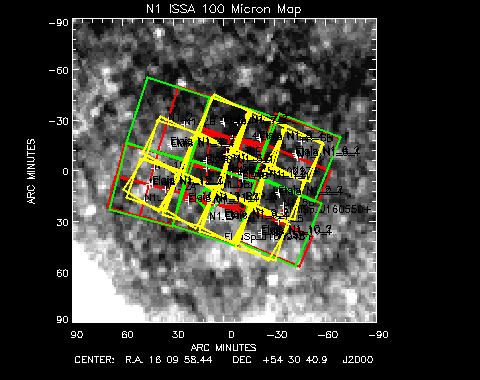 Figure 1:
Coverage of the ELAIS survey in the N1
area. All the region is covered at 15 and 90 mu. In the center there is the
PHOT TEST raster and the 10 times repeated CAM observations. Almost all the
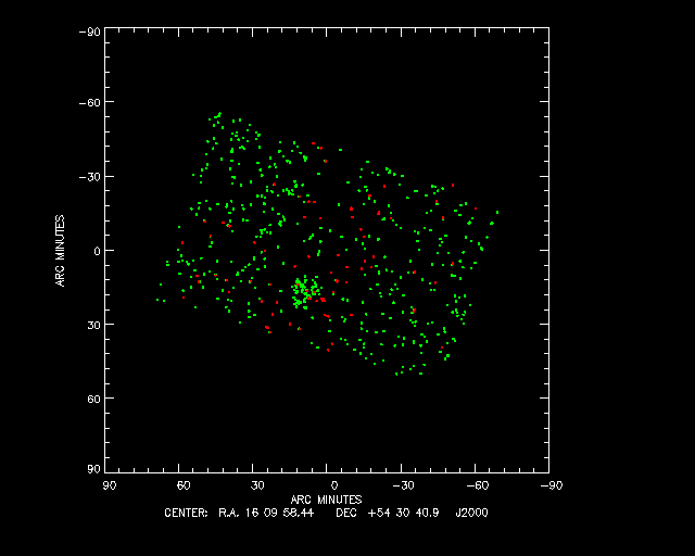
area has been covered by the FIRBACK survey at 175 mu. A map with sources
plotted is available here.
Figure 1:
Coverage of the ELAIS survey in the N1
area. All the region is covered at 15 and 90 mu. In the center there is the
PHOT TEST raster and the 10 times repeated CAM observations. Almost all the
area has been covered by the FIRBACK survey at 175 mu. A map with sources
plotted is available here.
ELAIS N2
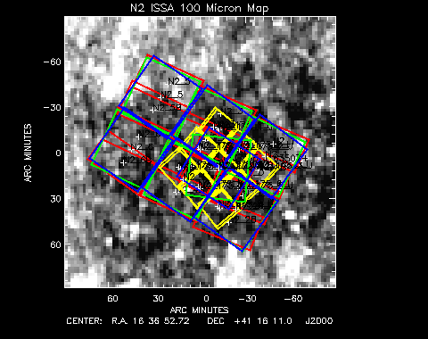 Figure 2:
Coverage of the ELAIS survey in the N2
area. All the region is covered at 6.7, 15 and 90µm. In the center
there is the CAM TEST raster observed at 6.7 and 15µm. Also in the
central area, the ELAIS group has done a survey at 175µm.
A map with sources plotted is available here.
Figure 2:
Coverage of the ELAIS survey in the N2
area. All the region is covered at 6.7, 15 and 90µm. In the center
there is the CAM TEST raster observed at 6.7 and 15µm. Also in the
central area, the ELAIS group has done a survey at 175µm.
A map with sources plotted is available here.
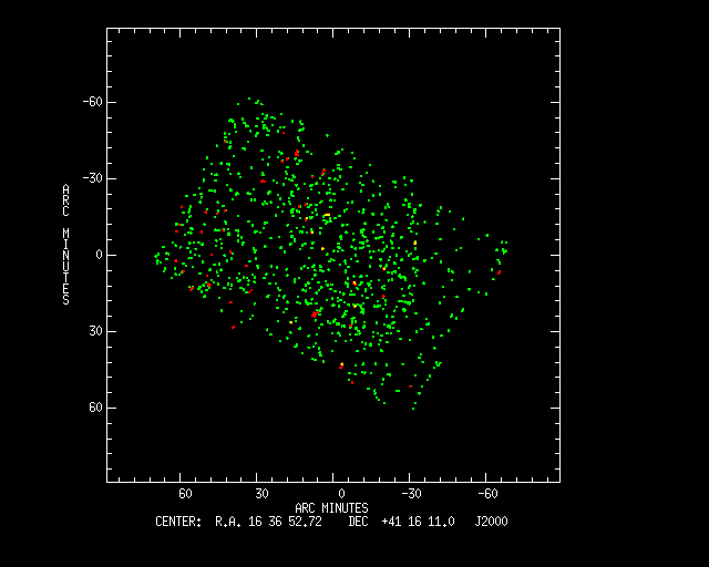
ELAIS N3
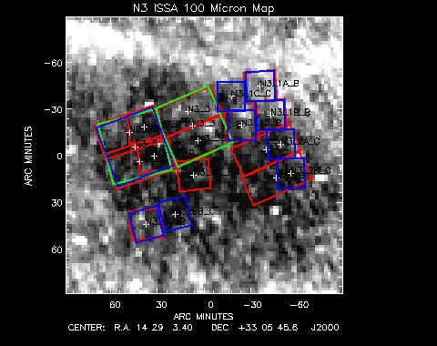 Figure 3:
Idem for ELAIS N3. A map with sources plotted is
available here.
[Back to main page]
Figure 3:
Idem for ELAIS N3. A map with sources plotted is
available here.
[Back to main page]